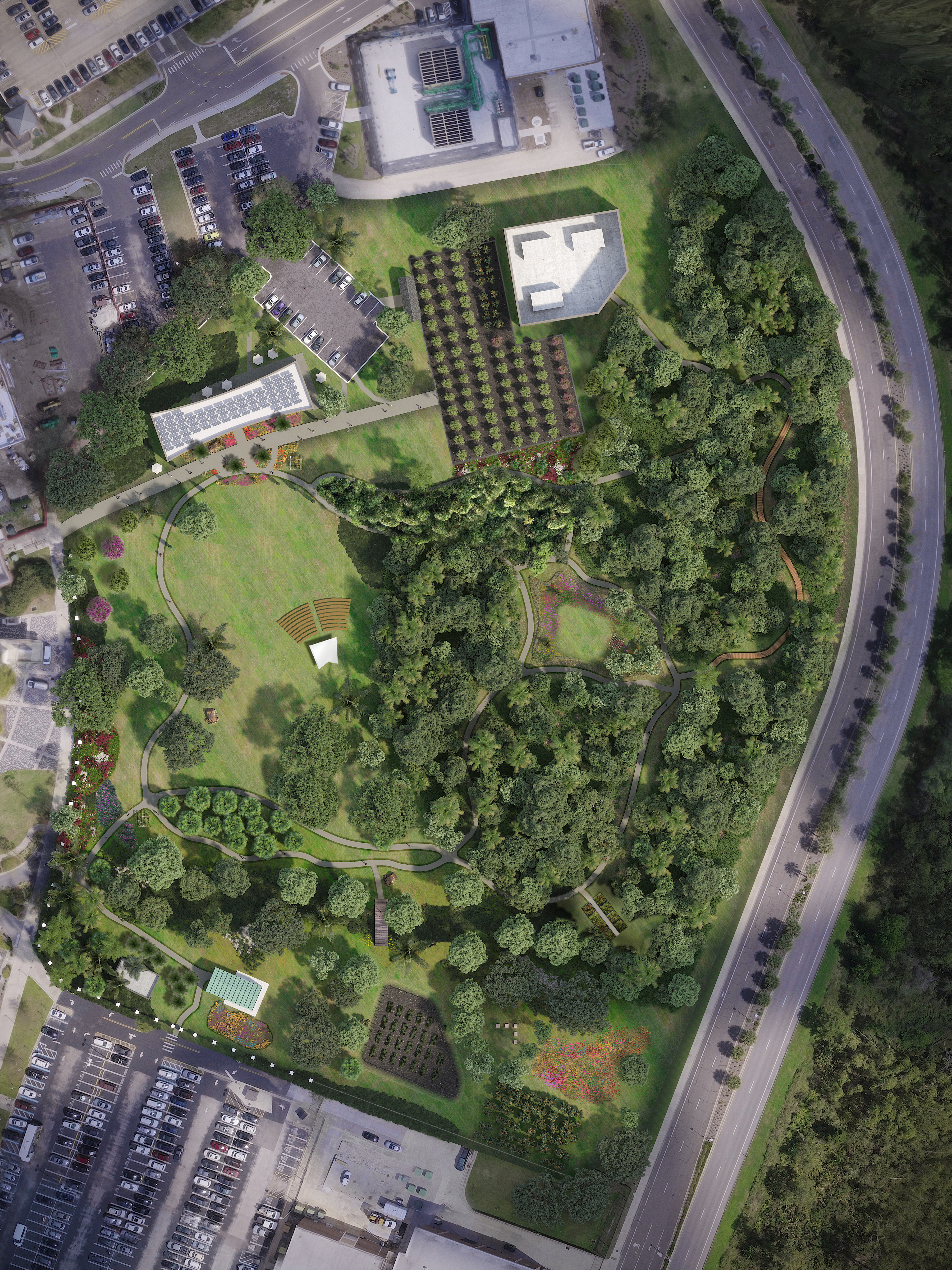
Photorealistic Drone Mapped Site Plan Rendering
UCF Arboretum
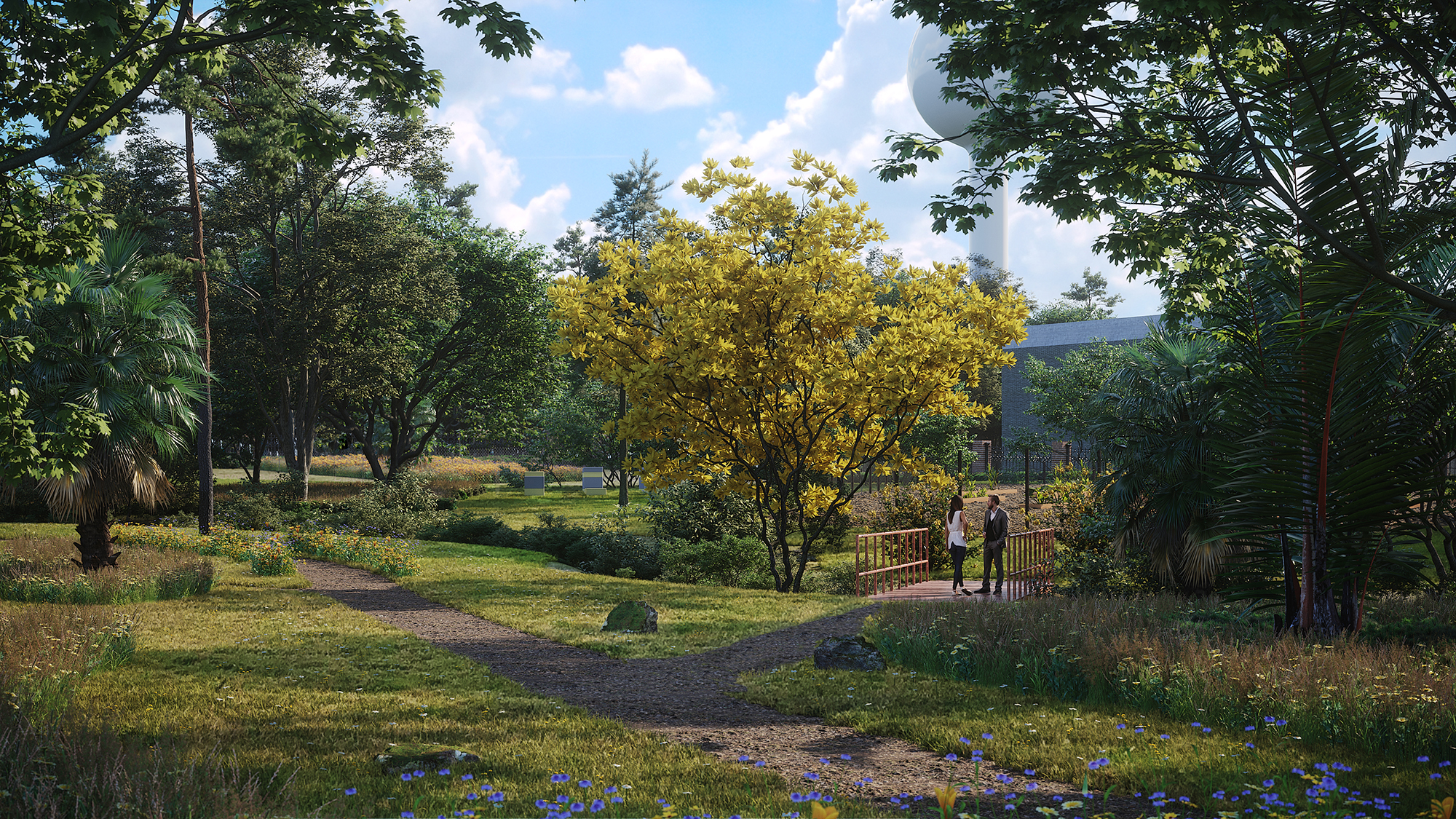
This CGI/ drone mapped site plan rendering was created to help the University of Central Florida’s Arboretum showcase their plan to develop and expand the community garden and park area on campus. This area helps feed their students and provides educational opportunities for the students and their local community. Talk about doing big things!
Site plans should highlight your property’s lifestyle and design features that set you apart. Our clear and colorful photorealistic site plan services do just that and so much more. Our photorealistic site plans like the UCF Arboretum project, offer accurate detailing that are also visually pleasing.
Our photorealistic plans differ from our regular 2d site plans in that these show more accurate detailing, which helps the viewer understand the project as a whole. In addition to showing the proximity to different amenities, highlights, major roads, etc. like a regular site plan would also show, these allow the viewer to understand the project on an emotional level. The visual allows the viewer to understand the lifestyle, culture, and full benefits of seeing the project through. That said, these detailed site plans are especially useful for gaining investors or donors, insurance purposes, approvals, and sales & marketing purposes.
How are these particular site plans created?
Drone Mapping & Drone Integration
Through multiple images taken by our FAA certified and licensed drone pilot, our mapping software will then collect the data to create a high-resolution and high-quality aerial map of the area. From there we model and render the project within the mapped area, creating a photorealistic visual of the “future” project.
Get a quote. Stay ahead of the industry and gain investors by using these photorealistic visuals on your website and in your salesrooms. These visuals are also wonderful for the beginning approval stages or attracting investors! Contact us for more information!
Other Site plan options: 2D photorealistic, 2D, or watercolor. With or without labels.